Saturday, August 22, 2020

Summer Fun With the Grandkids

One of the great joys of being retired and living back in BC again is that we have ample opportunity to spend time with our four grandchildren. Two live near us on Vancouver Island, and two live in Northern BC. 

Exploring Qualicum Estuary
 In the first half of the summer, we did several excursions with the two who live nearby. They are 5 and 8 years old.

E Claims his Private Island
Let's Build a Castle


The favourite destination on "Grandma Days" is the big playground at the Parksville Community Park. 

We Love to Climb
"Climb on, Grandma. We're taking off."


Ice Cream Cones, then a Walk on the Boardwalk at Parksville


Testing the Adult Gym Equipment

A Swim and a Picnic at Spider Lake


Bike Ride

Because our other set of grandchildren live in the northern part of the province, we don't get to see them as often. However, we were very fortunate to travel to Maui with them in late January, before the corona virus restrictions began. And we also were able to visit them this summer. 


They are 7 and 5, and love to ride their bikes. The first rainy morning, they rode their bikes and we walked through the new subdivision nearby that is under development. 

The dog enjoyed the walk too.


Grandpa and Granddaughter

We explored the Railway and Forestry museum, which was fascinating.


"Hurry up, Grandma!"


For Rob, a retired locomotive engineer, it was a walk down memory lane. The kids liked it because there was lots of interesting equipment to climb on. 

"Cool, I can reach the pedals."
"I'll race you!"


A highlight of our trip was a hike through The Ancient Forest. There were huge trees, the oldest perhaps 2,000 years old. 

Fallen Giant
On the Boardwalk


Admiring the Waterfall
Bat Girl


Another day, and another excursion on bikes. This on included a playground, a water park, and some time spent beside the river skipping stones.

"Let's shoot some leaves up the jets of water."
"That one skipped three times!"

Our grandchildren bring such joy into our lives.

Sunday, August 9, 2020

So Many Waterfalls

In my last post about our camping trip to Strathcona Park, I mentioned that Rob and I saw several waterfalls. But first, I'm going to start by showing you a photo of a waterfall close to home. 

Cedar Creek

 I've mentioned before that I live in a semi-rural area. There is a large network of trails right outside my door, and I walk on them several times a week. This image above is of a waterfall created by a small seasonal creek on "my" network of trails. I'm cheating a bit here, because I took this photo a couple of months ago when the weather was rainy. I hiked along Cedar Creek recently, and the waterfall has disappeared until the next rainy season. 

No Name Waterfall
 This dramatic waterfall is not really named "No Name Waterfall." I'm calling it that because neither Google Maps nor my Backroads map book supply a name for it. (I need to invest in a better map.) This waterfall can viewed from historical site and rest stop along Highway 28 between Upper Campbell Lake and Gold River. The photo you see is the portion of the waterfall above the highway. It crosses under the road and continues to plunge another 1,000 feet to the Heber River below. 

The Heber River passes through a narrow canyon at this point. Although it is hard to get a good view from above, there are some impressive rapids and waterfalls on the Heber River as well.

Rob at Lady Falls
Jude at Lady Falls
 These photographs do not do justice to this impressive waterfall. Lady Falls is much larger than it looks in the photos. Although it was a sunny afternoon, the area all around the falls was misty and wet from the force of the plunging water. 

What you also can't see is that the viewing platform is cantilevered out over the lower section of the falls. Rob is standing there bravely with his hands in his pockets, whereas I didn't quite bring myself to let go of the slippery guard rails. 

This trail is accessed off Highway 28, near the top of Upper Campbell Lake. It is a beautiful trail through big trees, Douglas Fir and Hemlock. I believe it was about 3 kilometers round trip, although we did gain quite a bit of elevation switch-backing up to Lady Falls.

Lower Myra Falls, Looking Up
Lower Myra Falls, Looking Down

Lower Myra Falls was, in my opinion, the most spectacular waterfall that we saw on this camping trip. It is a short drive away from one of the big provincial campgrounds on Buttle Lake. The easy, well-maintained trail is about a 1.5 kilometer loop. However, the disadvantage of Lower Myra Falls is that because it is so accessible, there were a lot of people there on this beautiful sunny summer day. It wasn't easy to get photos without people in them!

We left Lower Myra Falls and decided to do a second hike to Upper Myra Falls. In order to get there, we had to drive through a large, active mine. Myra Mine, which extracts zinc, copper, and gold, was fascinating, but I forgot to take a single picture of it. We signed in and parked within the mine area in order to access the trail head. This area in the heart of Strathcona Park is presently designated as a mixed use area, and there is a plan in place to eventually shut the mine down and have it revert to parkland. 

Our map book described Upper Myra Falls as an easy 3 kilometer hike. It was neither easy nor 3 kilometers. My fitness device recorded the distance we walked to and from Upper Myra Falls as 9 kilometers. 

As it turned out, the trail head was a one kilometer walk from the trail parking lot. We wasted a lot of steps walking in circles looking for the trail head. A diamond driller who worked at the mine and who was out for an afternoon stroll finally pointed us in the right direction. The 3 km referred to the distance one-way from the trail head to the falls. We gained a lot elevation on a narrow rooty trail to get to the falls, so I would describe the trail as moderate rather than easy. Nevertheless, it was a nice hike through the forest.

Upper Myra Falls

Upper Myra Falls was not as pretty as Lower Myra Falls but it had quite a drop. Those two brown sticks that look like toothpicks beside it are actually full-sized logs, so that gives you an idea of the height of the falls. 

We were tired, but happy that we'd explored another interesting part of Strathcona Park.


Monday, August 3, 2020

Everybody's Gone Camping

And we have been camping this summer too.

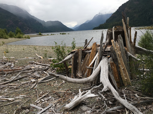
Driftwood Structures on the Lake Shore

Our Public Health Officer for the Province of BC, Dr Bonnie Henry, has encouraged British Columbians to get outside and enjoy the summer. Of course, to keep the infection rate of COVID-19 low, she reminds us to limit our contacts to (the same) small group, maintain a physical distance of 2 meters (six feet), wash hands frequently with soap and water or use hand sanitizer, and wear face masks in small enclosed spaces or indoors where physical distancing is not possible.

Sandy Beaches and Wildflowers

Our first camping trip of the year was to beautiful Strathcona Park, a huge wilderness in the interior of Vancouver Island. Established in 1911, it was the first provincial park to be designated in BC. A portion of the park lies within the Clayquot Sound Biosphere Reserve, a UNESCO environmental reserve.

In the 1980's, the government of the day wanted to make the park smaller in order to expand industry into the area (mining and logging). Many people came out and protested, setting up road blockades. As a result, the park was saved and even expanded. A park management plan was set up.

It contains a number of tall mountain peaks, including the Golden Hinde at 2,198 meters (7,211 feet), the tallest mountain on the Island. The park also contains Della Falls, the highest waterfall in Canada. Della Falls is not easy to get to. There is no road access. People can get to it by canoeing down a lake, and then doing a challenging hike.

We did not go to Della Falls, but we did visit several other spectacular waterfalls in the area, which I will write about in a separate post.

A Windy Afternoon at the Lake

Strathcona Park has two large provincial campgrounds that can be accessed from Campbell River via the Gold River highway. They are the Buttle Lake and Ralph River campgrounds, both situated on Buttle Lake.

As it turns out, everybody in BC has decided to go camping this year. What better time than a pandemic to enjoy the beautiful outdoors? The provincial parks and most of the regional parks as well are giving priority to BC residents for camping reservations. It is almost impossible to get a reservation at many parks. And, whereas in years past, we were usually able to get a non-reservable campsite via the  "first-come-first-served" system, now many of the campgrounds are reservation-only.

So we felt very lucky to get a site for four nights at Buttle Lake. We were also lucky that our trip there was earlier in July when the weather was cloudy and cool; therefore the hiking trails and beaches were not crowded.

Although we had brought our belly boats and fly fishing gear, we ended up not taking our boats out on the water as it was quite windy most days. However, we did fish from shore (spin casting) and I caught and released a small one.

Environmental Restoration

A Beautiful Hike Through a Hemlock, Cedar, and Douglas Fir Forest
Along the shores of the lake, we saw environmental restoration of the sandy banks in progress. According to the informational sign, parks staff are exploring various methods of reclaiming damaged areas. What you are looking at in the photo above are segments of branches, or withies, that have been stuck in the ground and allowed to root. They used native plants such as willow, red osier dogwood, and cottonwood.

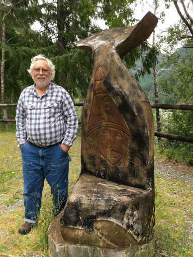
Site of Historic Battle
We did a lot of hiking on our short camping holiday. We explored most of the trails in the park that were within walking distance of our campsite. Our hikes included walks all along the lake shore and out to a marine campground, a hike to a lovely stream, and the Darkis Lake loop.

We also some side trips. including a hike to Lady Falls, a hike to lower Myra Falls, and a hike to Upper Myra Falls.

On one of the days there, we did a road trip to Gold River, an area of the Island I had never seen before. The highway curved around Upper Campbell Lake, then followed the Elk River to Gold River, a small community situated near t


he head of an inlet on the west side of the Island.

High above the river, we stopped at a historic site. According to the information sign, it was at this location the the Muchalaht and Mowachaht people met and had a battle.  Since that time, the two First Nations have combined.

This is an area I would be happy to visit again. There are so many areas to explore, and many lakes that are great for fishing.

But, during the summer of 2020, I predict that the competition for camping sites will continue to be fierce.